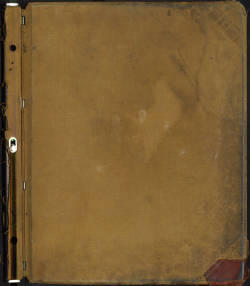
The book contains 146 plats detailing property boundaries and ownership and leasing of lands on the Pine Ridge Reservation dating between 1936 and 2005. Changes to the plats are recorded on transparency sheets that are placed on top of the original pages. In order to provide as much detail as possible, the digitized copy of the original contains three scanned images for each plat: the transparency sheet and the original sheet, the transparency sheet alone, and the original sheet alone.
The beginning of the book includes a page describing the color code for the shading found within the pages of the book. The shading represents status of the land. Much of this page is faded and difficult to read.
The next page of the book is a typewritten copy of the "Order of Restoration, Pine Ridge Reservation," dated June 10, 1936 and attributed to Harold L. Ickes, United States Secretary of the Interior (1933-1946). The text of the document is as follows:
"Whereas, under authority contained in the Act of Congress approved May 27, 1910 (36 Stat. 440), providing for the classification and disposition of surplus unallotted lands in Bennett County, in the Pine Ridge Reservation, State of South Dakota, certain classes of said surplus lands were opened to settlement and entry under the general provisions of the homestead laws and of the said Act of Congress, by Presidential proclamation of June 29, 1911 (37 Stat. 1691), and Whereas, there are now remaining undisposed of on the opened portion of the Pine Ridge Reservation a number of tracts of said surplus lands which, while of little value for the original purpose of settlement and entry, upon thorough investigation have been found to be valuable to the Indians of the said reservation, and Whereas, by relinquishment and cancellation of homestead entries a small additional area of similar lands may be included within the class of undisposed of surplus lands, and Whereas, the Tribal Council, the Superintendent of the Pine Ridge Reservation, and the Commissioner of Indian Affairs have recommended restoration to tribal ownership of all such undisposed-of lands in the said reservation. Now, therefore, by virtue of the authority vested in the Secretary of the Interior by Sections 3 and 7 of the Act of June 18, 1934 (48 Stat. 984), I hereby find that restoration to tribal ownership of all lands which are now, or may hereafter be, classified as undisposed-of surplus opened lands of the Pine Ridge Reservation, will be in the public interest, and the said lands are hereby restored to tribal ownership for the use and benefit of the Oglala Sioux Tribe of the Pine Ridge Reservation of South Dakota, and are added to and made a part of the existing reservation, subject to any valid existing rights." The Pine Ridge Reservation plats comprise the subsequent pages. The reservation is home to the Oglala Lakota people. It is located in the southwest part of South Dakota in Oglala and Bennett Counties and portions of Jackson County. The boundaries of the Pine Ridge Reservation were established by the United States government through the act of March 2, 1889 (25 Stat. L. 888).
United States. Bureau of Indian Affairs